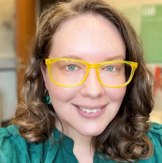
Cheryl Knott is the Research Manager and Interim Director for the Baltimore Neighborhood Indicators Alliance-Jacob France Institute. Since 2007, Cheryl has worked to ensure the accuracy, consistency, and reliability of community indicators that describe the quality of life for Baltimore City communities. She coordinates with staff and external data-creating agencies to produce customized statistical and research reports and evaluations that examine neighborhood-level trends on socio-economic characteristics, crime and safety, public health, housing and community development, educational achievement, and sustainability.
Cheryl also provides training to the public on using data resources, community asset mapping, evidence-based practices, and communicating data for grant writing. Cheryl is involved in coordinating Baltimore Data Day, an annual event that brings together a diverse audience to talk about data and resources in the city. She is a proponent of data democratization and has a strong interest in making data open and usable to the public as well as other professionals.
Prior to her arrival at BNIA-JFI in 2007, Cheryl studied at the University of Maryland, Baltimore County (UMBC), receiving her Bachelor’s degree in Geography and Environmental Systems and a certification in Cartography in 2007 and a Master’s degree in Applied Sociology in 2013. She received a graduate certificate in Organizational Leadership from the University of Baltimore in 2022. Her research interests include the relationship between crime and the built environment, including developing new quantitative measures for studying urban crime risk at the block level.
In 2017 Cheryl was awarded the University of Baltimore Staff Award for Extraordinary Public Service to the University and Greater Community for her work on communicating data and information. She recently served two terms as the Data and Resources Subcommittee Chair for the Maryland State Geographic Information Committee (MSGIC) and is currently appointed to the Maryland Council on Open Data. In her spare time, Cheryl is a co-organizer for MaptimeBmore.
Projects
- Vital Signs
- Baltimore Data Day/Week
- Baltimore Community Change 2010-2020 Project
- Data Science Corps to Improve the Quality of Life in Urban Areas
- Project VITAL: Vacant Lot Improvement to Transform Adolescent Lives
- Perkins, Somerset, Oldtown (PSO) Transformation Dashboard
- COVID-19 Mapping and Data Dashboards
- Evaluating and Using Open Data Portal Technology for Social Good
- Baltimore City Early Childhood Care & Education Landscape Analysis
- Equity Analysis of Baltimore City’s Capital Improvement Plan
- Data-Driven Local Outreach for the 2020 Census
- GEOLOOM co>map
- “Smart Cities” Initiative
- McElderry Park Crime Reduction
- Baltimore Community Foundation Target Neighborhoods Evaluation
Additional project details can be found at All Research – BNIA-JFI.
Reports and Publications
- Vital Signs 16 (April 2018)
- Vital Signs 15 (April 2017)
- McElderry Park Byrne Criminal Justice Innovation Grant – Final Report for Year 3 Funding (2015-2016) (May 2017)
- McElderry Park Byrne Criminal Justice Innovation Grant – Final Report for Year 2 Funding (2014-2015) (May 2016)
- Vital Signs 14 (April 2016)
- Vital Signs 13 (April 2015)
- McElderry Park: Community Plan for Crime Reduction (March 2015)
- Vital Signs 12 (April 2014)
- Vital Signs 11 (April 2013)
- The Lines Between Us – WYPR’s Maryland Morning Show – maps and data visualizations (Fall 2012—Summer 2013)
- An Analysis of the Exterior Repair Program Conducted by The Associated Black Charities of Maryland (October 2010)
Conference Presentations
- “Building Community Indicators for Improving Baltimore’s Neighborhoods”; TUgis: Maryland’s Geospatial Conference; Towson, MD; August 2018.
- “Working with University Students”; National Neighborhood Indicators Partnership Meeting; Indianapolis, IN; October 2017.
- “The Ins and Outs of Data for Community-Based Indicators”; ESRI Mid-Atlantic Users Group Conference; Rockville, MD; April 2017.
- “McElderry Park Data Viewer”; TUgis: Maryland’s Geospatial Conference; Towson, MD; March 2017.
- “McElderry Park, Baltimore: Community-Led Strategies for Crime Reduction”; Association for Community Health Improvement Annual Conference; Baltimore, MD; March 2016.
- “A Re-Examination of Population Inputs for Neighborhood Indicators with Applications for Crime Reporting”; American Sociological Association Annual Meeting; San Francisco, CA; August 2014.
Community-Based Trainings
- “Using Community Indicators to Improve Baltimore’s Neighborhoods”; Neighborhood Institute; April 2018.
- “Using Indicators to Improve Your Community”; Enoch Pratt Free Library; October 2017.
- “Accessing Open Data: Baltimore Neighborhood Indicators Alliance”; Baltimore Data Day; July 2012-2017 (annual event).
- “Data for Non-Profits: Baltimore Neighborhood Indicators Alliance”; Baltimore Innovation Week; October 2015.

